
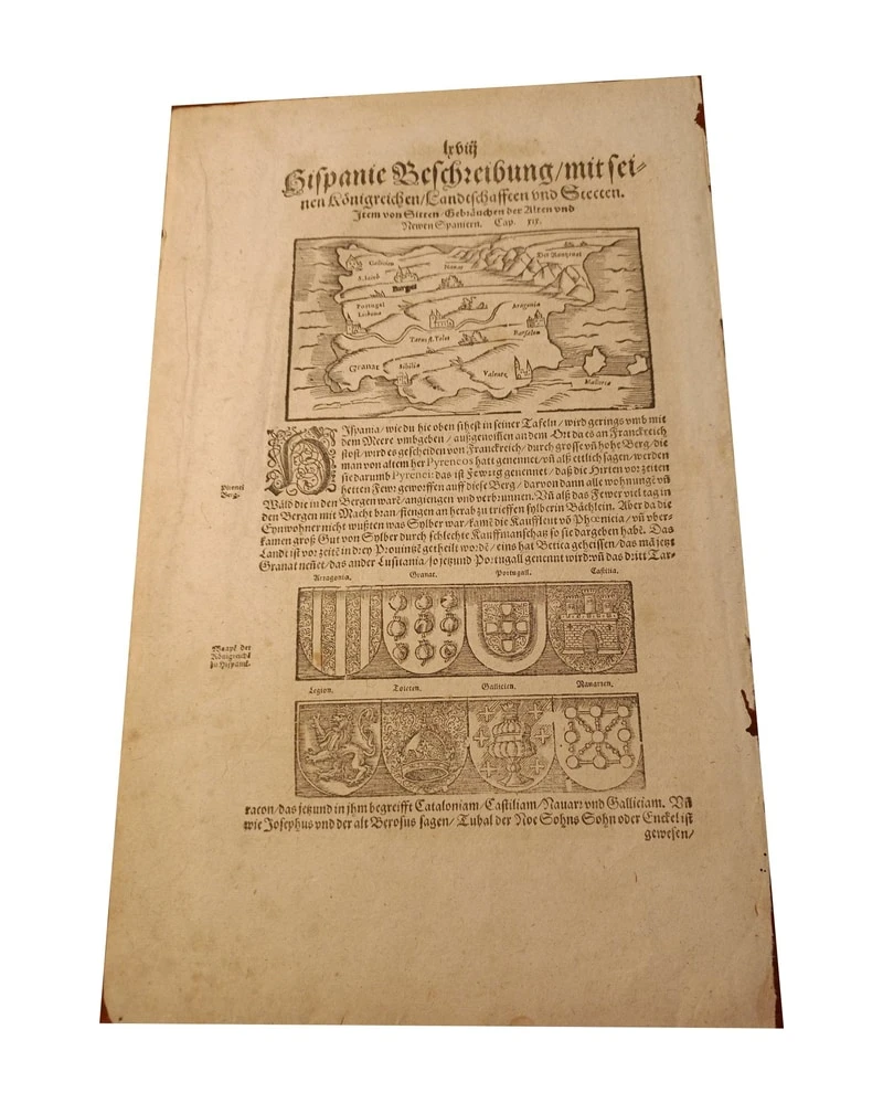
Antieke gravure uit 1544, Duitse uitgave van Spanje door Münster
Art & Paintings · 17th Century
Prijs van het stuk
150 €
Verzending schatten
Waarheen verzenden we?
Ook gratis ophalen mogelijk in Sant Andreu de Llavaneres
Vraag naar de verzending, de staat, de geschiedenis of stel een andere vraag.
Beschrijving
Loose leaf with a detailed description of Hispania, accompanied by an antique engraving illustrating the region. The reverse of the sheet contains text about the kingdom of Scotland. The engraving shows maps and coats of arms, typical of historical documents from the 17th century. The sheet shows signs of aging, consistent with its antiquity, but maintains its structural integrity. It is a notable example of cartography and historical description of the time.
German Edition: Although the work Cosmographia was originally published in Latin, the first German edition appeared in 1544, gaining wide dissemination.
20.5 x 34 cm
In the field of antique book collecting and cartography, the referenced engraving belongs to the famous German editions of the Cosmographia by Sebastian Münster (mostly printed in Basel by Heinrich Petri or his son Sebastian Petri). It is a loose leaf from this book, an important engraving.
Type of engraving: It is a woodcut. The drawing and text were carved in relief on a wooden block. The text in German was printed using movable lead type inserted into the recesses of the same wooden block. The text and the language: It uses the typeface known as Schwabacher or Fraktur (German Gothic script). The exact title that appears at the top of the page is usually "Hispanie beschreibung mit" or similar, depending on the year. The reverse: Being a sheet extracted from a book (and not an independent atlas map), the reverse always contains text in German that continues the geographical description, in this case, it is the chapter that discusses the kingdom of Scotland.
This document is a wood-engraved page, probably from the famous work Cosmographia by Sebastian Münster, published around 1544-1580. The map shows the Iberian Peninsula (Spain and Portugal) with ancient geographical details and coats of arms of the kingdoms at the bottom. The text printed in Old German describes the region, mentioning kingdoms such as Catalonia, Castiliam, Nauarr, and Galliciam. It is a collectible item of ancient cartography, valued for its historical importance and the use of 16th-century woodcut techniques.
Gebruikssuggesties
Exhibit in an antique map collection
Use as an educational piece in a history class
Frame for decoration in a library
Include in an exhibition on the history of Europe
- Eeuw
- 17th Century
- Materiaal
- Papier
- Staat
- Original, good condition
- Afmetingen
- 34 cm × 24 cm
- Geplaatst op
- 15 juni 2026
Verkocht door

L'Art de la Memòria✓Geverifieerd
Antigüedades sobre papel. Cartografía antigua. Catalonia. Geography
Sant Andreu de Llavaneres, España
Verzending en verzekering
Wat kost de verzending?▾
De verzendkosten worden door de verkoper bepaald op basis van de bestemming en de kenmerken van het stuk. U hoort ze na bevestiging van de aankoop.
Is het stuk verzekerd?▾
De verkoper regelt de verzendverzekering. We raden aan de dekking vóór verzending te bevestigen.
Hoe lang duurt de levering?▾
De levertijd hangt af van herkomst en bestemming. De verkoper geeft u na de aankoop een schatting.
Worden retouren geaccepteerd?▾
Elke verkoper kiest een van de vier retourbeleiden van Antiga (retour binnen 14 dagen, alleen ruilen, alleen bij gebreken of geen retour). Het beleid voor dit stuk staat naast de prijs.
Gerelateerde artikelen

Vergelijkbare stukken

Kaart van de Golfkust van de Verenigde Staten, 1863, door Bache
Art & Paintings
19th Century · Estados Unidos
Papier
L'Art de la Memòria · Sant Andreu de Llavaneres
299,5 €
Tabula Asiae door Sebastian Münster, Editie 1545
Art & Paintings
16th Century
Papier
L'Art de la Memòria · Sant Andreu de Llavaneres
750 €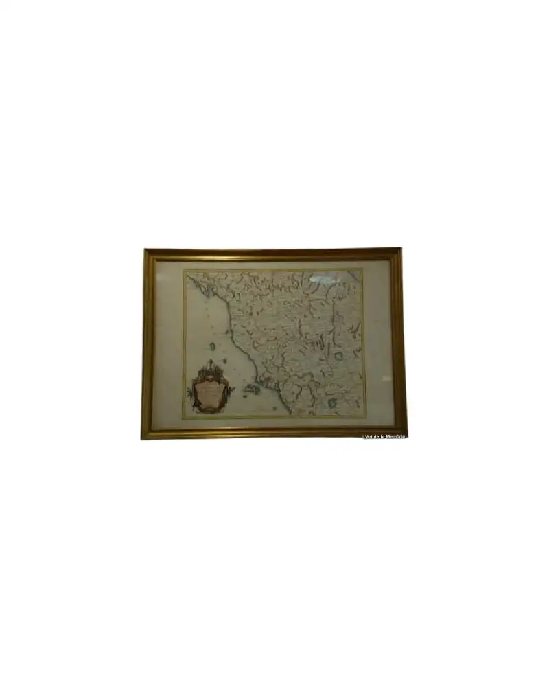
Kaart van het Groothertogdom Toscane door Santini/Remondini, 1776
Art & Paintings
18th Century · Italia
Papier, inkt
L'Art de la Memòria · Sant Andreu de Llavaneres
465 €
Zeekaart van Muroran Kō, 1972
Art & Paintings
Second half of the 20th Century · Muroran Kō, Japón
Papier
L'Art de la Memòria · Sant Andreu de Llavaneres
90 €
Kaart van Tartarije door Frederick de Wit, 17e eeuw
Art & Paintings
17th Century · Países Bajos
Kopergravure
L'Art de la Memòria · Sant Andreu de Llavaneres
881 €
Kaart uit 1943 van Guayanilla Harbour, Puerto Rico
Art & Paintings
First half of the 20th Century · Puerto Rico
Papier
L'Art de la Memòria · Sant Andreu de Llavaneres
160 €
1845 Monnier, Bourguignon-duperré en Lieussou Plan Du Port de Marseille
Art & Paintings
19th Century · Francia
Papier
L'Art de la Memòria · Sant Andreu de Llavaneres
350 €
Kaart van het Caraïbisch gebied door Bowen, 1747
Art & Paintings
18th Century · Reino Unido
Papier, GRAVURE
L'Art de la Memòria · Sant Andreu de Llavaneres
499,5 €